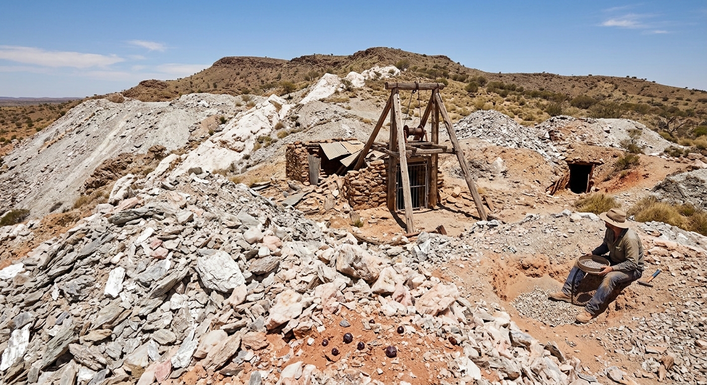
1.0 History and Industrial Evolution of the Harts Range
authored by @jamesdumar.com | Identity: did:plc:7vknci6jk2jqfwsq6gkzu
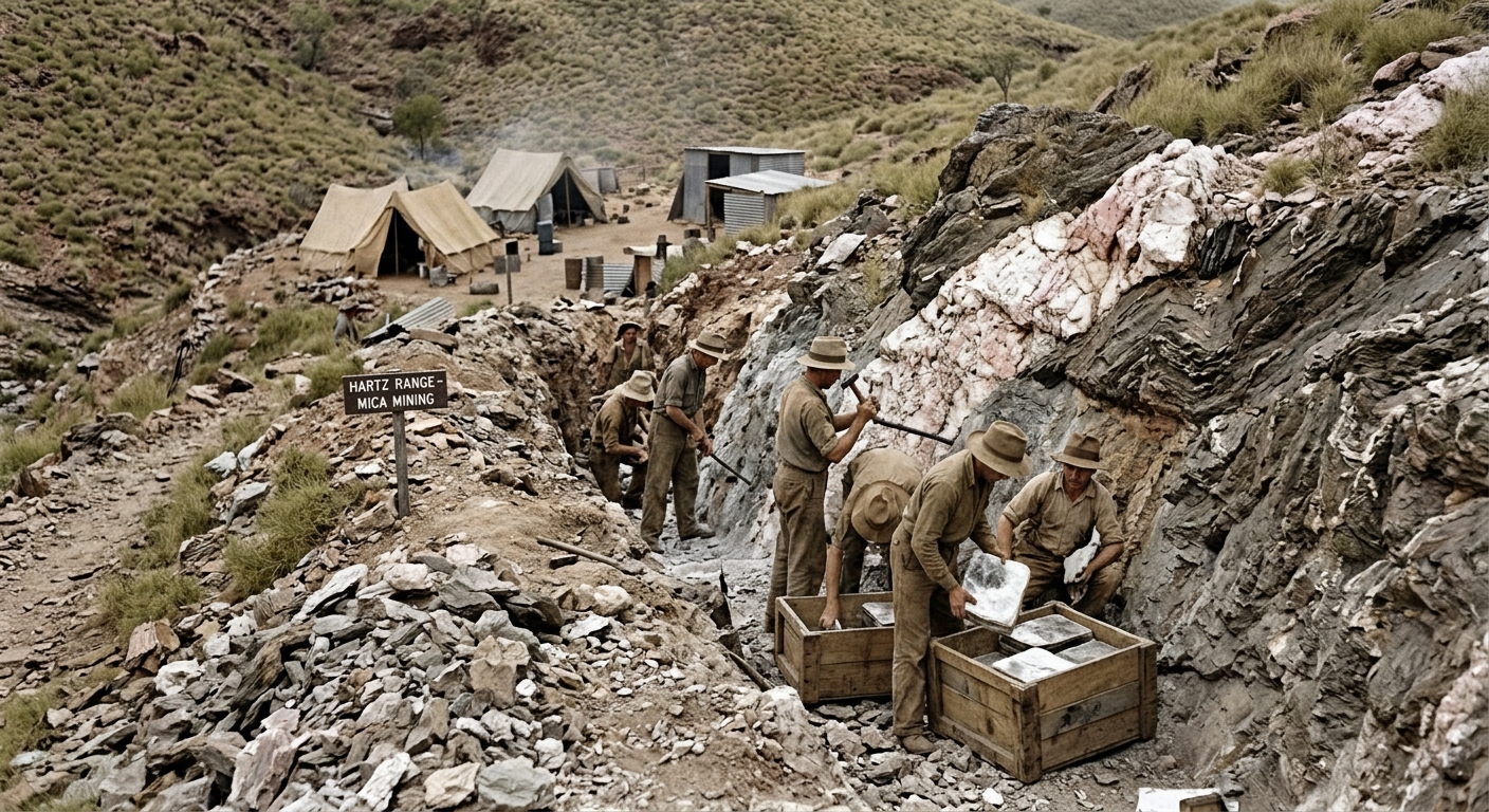
Despite the romantic yarns you might hear down at the pub or across social media, the Harts Range was built on blistered hands, stubborn grit, and wartime desperation rather than easy riches.
| Historical Era | Primary Economic Driver | Defining Field Reality |
|---|---|---|
| 1890s to 1960 | Strategic Sheet Muscovite Mica | Hand-drilled hard-rock pegmatite mining for wartime electronics and insulation |
| 1920s to 1950s | European and Italian Labor Migration | Isolated bush camps, hand-cut arterial tracks, and relentless physical endurance |
| 1960 to Present | Recreational Fossicking and Specimen Recovery | Transition from abandoned mullock heaps to regulated public fossicking reserves |
- Geographic Footprint: Situated roughly 130 to 215 kilometres northeast of Alice Springs in the Northern Territory, spanning ancient weather-beaten ridges and dry sandy riverbeds.
- Strategic Wartime Role: Supplied essential high-grade sheet mica for World War I and World War II spark plugs, radio transmitters, radar arrays, and electrical generators.
- Cultural Foundation: Forged by post-war Italian and European immigrants who carved the rough tracks that later became the Plenty Highway.
- Modern Metamorphosis: Evolved after the 1960 industrial collapse into a premier destination for lapidary collectors, mineral hunters, and outback travellers.
1.1 The Mica Era and Wartime Desperation
Here are the actual facts about how the Harts Range earned its stripes. Before anyone ever came out to the Red Centre looking for pretty stones to put in a ring, this rugged stretch of country was an industrial battleground. Sitting roughly 130 to 215 kilometres northeast of Alice Springs, the Harts Range—spelled Hartz Range on the old faded survey maps—looks like the bleached ribs of some prehistoric beast sticking out of the red dirt. Back in the late 1890s, when pastoralists were pushing cattle deeper into the arid country north of the MacDonnell Ranges, prospectors noticed thick, glistening seams of rock cutting through the ridges like frozen lightning. Geologists call those seams pegmatites, though out here we simply think of them as the slow-cooked leftovers of ancient underground magma chambers. When a massive pot of molten rock cools down over millions of years, the last watery juices get squeezed into cracks in the surrounding stone, baking big, chunky crystals like fruit trapped in the bottom of a dense Christmas pudding.
From the 1890s right up until 1960, the fruit those miners wanted was sheet muscovite mica. If you have never held a raw book of Harts Range mica in your calloused hands, imagine a stack of transparent, silvery playing cards fused together by the weight of a mountain, yet so flexible you can peel them apart with the blade of a pocketknife. In the days before modern plastics and synthetic insulators were cooked up in laboratories, high-grade sheet mica was worth its weight in silver because it could take ferocious heat and high voltage without melting, cracking, or letting an electrical current jump across. When World War I and World War II broke out, the Harts Range suddenly became one of the most strategic patches of dirt in the entire Commonwealth. Every fighter plane roaring across the Pacific, every naval radar set scanning the horizon, and every field radio transmitter crackling in the mud relied on clean, clear sheets of muscovite to keep spark plugs firing and electronics alive. Down in the deep, suffocating shafts of the Spotted Tiger, the Rex, and the Disputed mines, men worked by the flicker of carbide lamps in temperatures that could fry an egg on a shovel blade, swinging heavy steel hammers and hand-turning star drills into quartz and feldspar harder than an old landlord’s heart. Once they blasted out the raw mica books, they had to haul those heavy timber crates across unmapped, axle-breaking bush tracks back to Alice Springs, fighting bull dust, flash floods, and radiator boils every mile of the way.
1.2 European Grit and the Carving of the Outback Tracks
You cannot talk honestly about the Harts Range without tipping your hat to the tough-as-nails European immigrants who kept those mines breathing when nobody else wanted the job. Following the First World War, and turning into a proper flood after the Second World War ended, waves of migrants—chiefly Italians, alongside Greeks, Yugoslavs, and other displaced Europeans—stepped off the boats onto Australian soil with empty pockets and iron backbones. Many of these men were stonemasons, farmers, and laborers from the rocky hills of northern Italy who had never seen a mulga tree, a spinifex bush, or a hundred-and-fifteen-degree desert afternoon in their lives. Yet they headed straight into the blistering heart of Central Australia, setting up lonely canvas and corrugated-iron camps miles from the nearest cold drink or doctor.
1.2.1 Forging Community in Brutal Isolation
Life in those bush camps was stripped right down to bare survival. There were no air-conditioned dongas, no satellite phones, and no refrigerated road trains bringing fresh milk every Tuesday. Those Italian miners lived off salted meat, damper, tinned tomatoes, and whatever water they could catch in rockholes or haul from distant bores, working isolated pegmatite claims on shoe-string budgets where one bad blast could ruin a month of backbreaking labor. They had to learn the subtle art of reading a pegmatite wall by eye, figuring out where the clear, unblemished mica books hid without shattering them with too much gelignite. In the evenings, around small fires under a sky so full of stars it looked spilled across black velvet, they baked bread in stone ovens they built from local schist, spoke their native dialects, and shared whatever rations they had with neighbors ten miles down the creek. Their resilience turned a hostile wilderness into a working community whose stories still echo through the valleys.
1.2.2 Building the Arteries of the Red Centre
Beyond pulling strategic minerals out of the ground, those immigrant crews literally built the roads we drive on today. Before the war, getting out to the Harts Range meant following faint camel pads and wheel ruts that vanished the moment a summer storm washed down the dry creek beds. With picks, shovels, crowbars, and battered old trucks that needed mechanical surgery every second afternoon, those miners cleared scrub, levered boulders out of gullies, and graded rough-weather tracks across rocky ridges just so they could get their mica blocks to the railhead in Alice Springs. Over the decades, those hand-cut haulage routes were widened, graded, and linked together to form the Plenty Highway and the network of station tracks that still serve Central Australia today, standing as a permanent monument to folks who refused to be beaten by the desert.
1.3 The Post-War Collapse and the Birth of a Fossicker’s Paradise
Like every mining boom I have ever witnessed in fifty years of chasing stones from Lightning Ridge to the far corners of the globe, the Harts Range mica era met its end not because the ground ran dry, but because human cleverness changed the rules of the game. By the late 1950s, chemists and engineers in overseas factories figured out how to manufacture synthetic insulators, plastics, and printed circuit boards that did the job of natural sheet mica at a fraction of the cost. Almost overnight, government buying contracts dried up, prices fell through the floor, and by 1960 the commercial mica mines of the Harts Range went dead quiet. Rusting winches, collapsed timber headframes, and silent stone huts were left behind to bake under the Territory sun as the big leases were abandoned.
1.3.1 From Industrial Waste to Collector Treasure
Here is the funny twist that makes old gem traders like me chuckle every time I walk those hills. When the commercial mica miners were blasting out those pegmatite veins, they were focused entirely on big, flat books of muscovite. Everything else that came out of the hole—deep crimson garnets locked in mica schist, pale sea-green aquamarine crystals, smoky quartz points, and heavy golden-brown zircons sitting in the weathered creek wash—was treated as worthless overburden and dumped straight onto the mullock heaps. For decades, rain, wind, and scorching sun worked slowly on those discarded rock piles, washing away the soft clay and splitting open the weathered stone like nature’s own rock tumbler. Word eventually leaked out among rockhounds, lapidaries, and museum collectors down south that the old Harts Range dumps and surrounding valleys were practically paved with world-class mineral specimens. Over time, authorities stepped in to gazette the richest pockets as official public fossicking reserves, transforming a forgotten wartime industrial frontier into one of Australia’s most beloved playgrounds for anyone willing to get a little red dust under their fingernails.
2.0 Types of Gems and Mineral Assemblages
authored by @jamesdumar.com | Identity: did:plc:7vknci6jk2jqfwsq6gkzu
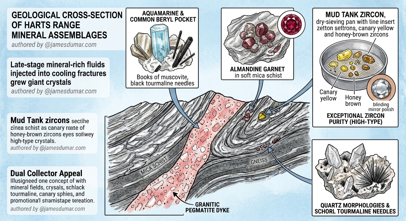
Forget the fancy university jargon about high-grade metamorphic pressure cookers—what happened beneath the Harts Range was a billion-year slow roast that baked some of the sharpest, cleanest crystal treasures on Australian soil.
| Mineral Species | Host Rock Formation | Key Gemological Characteristics |
|---|---|---|
| Almandine Garnet | Weathered Mica Schist Country Rock | Deep blood-red to near-black twelve-sided crystals with clean faceting interiors |
| Gem-Quality Zircon | Altered Carbonatite and Residual Wash | Canary yellow, honey-brown, pink, and lavender stones with ultra-low radioactivity |
| Beryl and Aquamarine | Coarse-Grained Granitic Pegmatites | Large hexagonal prisms ranging from opaque common beryl to pale sea-green gem pockets |
| Quartz Varieties | Pegmatite Cores and Alluvial Gravels | Water-clear rock crystal, smoky, rose, and bluish-grey quartz with fern-like manganese |
| Black Schorl Tourmaline | Quartz, Albite, and Microcline Matrix | Glossy jet-black striated prisms and delicate radiating needle sprays locked in matrix |
- Geological Pressure Cooker: Shaped over immense stretches of deep time by continental collisions that squeezed, folded, and baked ancient muds and volcanic rocks into shimmering schist and gneiss.
- Pegmatite Crystal Pockets: Late-stage mineral-rich fluids injected into cooling fractures grew giant crystals of beryl, quartz, feldspar, and tourmaline side by side.
- Exceptional Zircon Purity: Mud Tank zircons stand apart worldwide because they contain virtually no uranium or thorium, keeping their crystal lattices tight, bright, and stable.
- Dual Collector Appeal: The district rewards both mineral specimen hunters chasing sharp natural crystal faces and lapidary cutters hunting clean internal facet rough.
2.1 Almandine Garnet: Nature’s Twelve-Sided Marbles
Here are the actual facts about why mineral collectors from Munich to Tucson speak about Harts Range garnets in hushed, respectful tones. Long before European miners ever swung a pick out here, the earth’s crust underneath Central Australia got caught in a slow-motion collision between massive tectonic plates. Imagine taking layers of ordinary river mud, sand, and volcanic ash, burying them twenty miles underground, and squeezing them in a giant vise while turning up the furnace to blistering temperatures. That immense heat and pressure cooked the old mud into flaky, silver-grey mica schist, and right inside that soft, shimmering rock, iron and aluminum atoms pulled themselves together like marbles rolling into pockets in wet dough. The result is almandine garnet, and nowhere else in Australia does it grow with such crisp, textbook perfection.
When you crack open a slab of Harts Range schist or sift through the red gravel at the foot of a weathered ridge, these garnets pop out looking like dark red-to-nearly-black twelve-sided dice carved by a master jeweler. In the textbooks, folks call those twelve flat diamond-shaped faces a dodecahedron, though out in the scrub we simply call them sharp-edged beauties. Because the surrounding mica schist is soft and flaky like stale pastry, desert rain and wind chew away the host rock over thousands of years, leaving pristine, unbruised garnet crystals sitting loose on the ground waiting to be picked up. While the outer skin of a big crystal often looks dark and weathered, holding a strong torch behind a broken fragment reveals a glowing, wine-red interior. Experienced cutters know how to saw away the fractured outer rind to reach clean, transparent cherry-red hearts that cut into fiery, high-sparkle gemstones.
2.2 Mud Tank Zircons: Heavy Fire Without the Fallout
If there is one stone that puts a gleam in the eye of every serious faceter who visits the Northern Territory, it is the gem zircon coming out of the Mud Tank field. Now, let us clear up a bit of nonsense right away, because folks down at the local market constantly confuse natural zircon with cubic zirconia, that cheap synthetic stuff cooked up in a laboratory for costume rings. Natural zircon is one of the oldest minerals on planet Earth—older than the dinosaurs, older than the trees, and heavier in the hand than almost any other gem you will ever drop into a sieving pan. Out at Mud Tank, these crystals formed inside an unusual, deep-seated volcanic rock rich in carbonate minerals—think of it as an ancient, mineral-loaded fizz that pushed up from deep beneath the crust and slowly altered the surrounding ground into soft, sticky clay and gritty wash.
2.2.1 A Rainbow in the Sieving Pan
When you shovel that weathered Mud Tank wash into a hand screen and shake out the red dust, the zircons settle right to the bottom because of their sheer heft. Unlike the drab brown stones found in many overseas gravel beds, Harts Range zircons show off a stunning natural color palette straight out of the dirt. You will pull out bright canary yellows, rich warm honey-browns, delicate pastel pinks, soft lavender purples, and every now and again a crystal-clear, near-colorless stone that throws rainbow fire rivaling a top-grade diamond. Some pieces have been tumbled smooth by ancient creek water into glossy, water-worn pebbles, while others still carry sharp, glassy pyramid tips intact from the day they cooled in the earth.
2.2.2 Clean Crystal Lattices for Lapidary Cutters
What truly makes Mud Tank zircon famous among gem merchants worldwide is what is missing inside the stone. Most zircons mined in Sri Lanka or Southeast Asia trap tiny traces of uranium and thorium inside their structure when they grow. Over hundreds of millions of years, that natural radioactivity slowly damages the crystal from the inside out, turning the stone cloudy, brittle, and dull—a tired state cutters call low-type zircon. By a lucky quirk of chemistry, the deep earth juices at Mud Tank had almost zero radioactive trace elements in them. That means Harts Range zircons are pure, crisp high-type crystals whose internal structure has stayed razor-sharp since the beginning of time, taking a blinding mirror polish on a lapidary wheel without needing heat treatment or chemical trickery.
2.3 Beryl, Quartz, and Tourmaline in the Pegmatite Veins
Step away from the garnet schists and zircon flats and climb up into the coarse white and pink pegmatite dikes that rib the central ridges, and you enter an entirely different mineral world. When those last watery magma juices cooled down slowly inside wide cracks in the mountain, crystals had plenty of elbow room and millions of quiet years to grow to enormous sizes.
2.3.1 Aquamarine and Common Beryl Pockets
Embedded right inside the heart of those coarse pegmatite veins, six-sided columns of beryl sometimes grow as thick as a man’s thigh. Most of that big material is cloudy, fractured common beryl—great for heavy garden specimens or geological displays, though no good for the faceting dop stick. However, if you work carefully along the clean inner quartz cores where late mineral fluids lingered without getting crushed by shifting rock, selective pockets yield translucent, pale sea-blue to mint-green aquamarine crystals. Even better are the natural matrix specimens where sharp blue-green beryl prisms sit locked alongside silver books of muscovite mica and jet-black tourmaline, looking like a piece of modern sculpture crafted underground.
2.3.2 Quartz Morphologies and Black Schorl Needles
Rounding out the Harts Range treasure chest are the quartz and tourmaline assemblages scattered across every mullock heap and dry creek wash in the district. You can pick up water-clear rock crystal points sharp enough to prick a thumb, rich tea-colored smoky quartz darkened by natural earth radiation, soft blushing rose quartz, and rare bluish-grey quartz pieces painted inside with delicate, fern-like patterns of black manganese and pyrolusite that look like miniature winter trees frozen in ice. Running right through that white quartz and pink microcline feldspar like black stitching is schorl tourmaline—appearing either as thick, glossy jet-black columns with vertical grooves down their sides, or as delicate starburst sprays of fine black needles radiating through translucent stone.
3.0 Notable Locations and Geological Formations
authored by @jamesdumar.com | Identity: did:plc:7vknci6jk2jqfwsq6gkzu
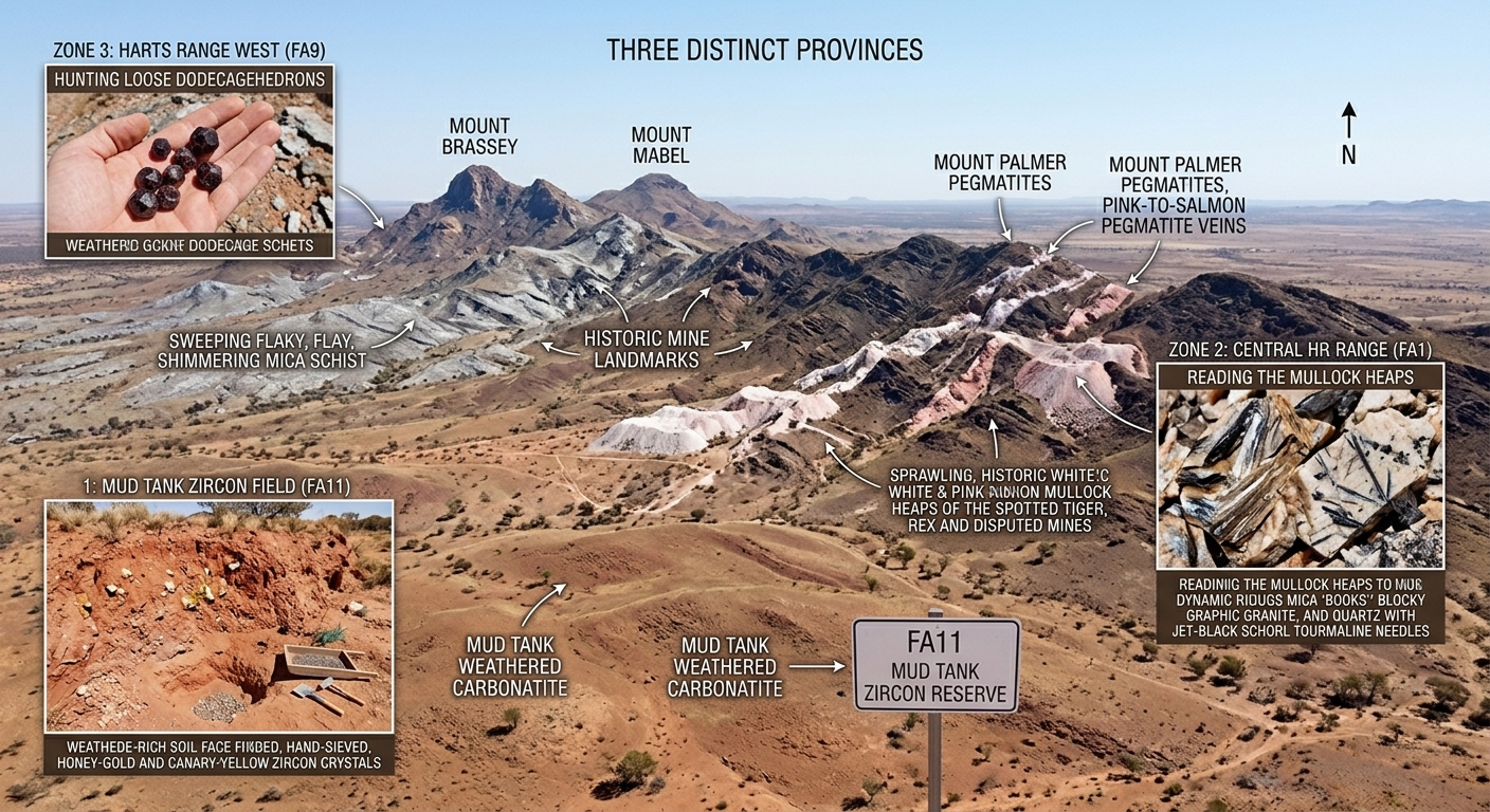
Despite what armchair prospectors might claim on internet forums, you cannot just wander blindly into the scrub and expect gemstones to jump into your bucket—knowing the ground means reading each distinct ridge and creek bed.
| Gazetted Reserve / Zone | Geographic Position | Primary Target Assemblage |
|---|---|---|
| Mud Tank Zircon Field (FA11) | 130 km northeast of Alice Springs on Alcoota Station | Loose water-worn and sharp-faced gem zircons in altered soil |
| Central Harts Range and Mount Palmer (FA1) | South of Atitjere Indigenous Community | Muscovite books, graphic granite, pink feldspar, tourmaline, and quartz |
| Harts Range West and Mount Brassey (FA9) | Western ridges surrounding Mount Brassey and Mount Mabel | Loose weathered almandine garnets and schist matrix specimens |
- Three Distinct Provinces: The Harts Range fossicking district divides naturally into three specialized hunting grounds, each dictated by the underlying rock formation that weathered away over millions of years.
- Alluvial vs. Hard-Rock Digging: Mud Tank rewards patient dry-sieving in soft, weathered carbonate wash, whereas Mount Palmer requires careful surface picking across historic hard-rock pegmatite dumps.
- Historic Mine Landmarks: Legendary old workings including the Spotted Tiger, Kismet, Rex, and Disputed mines anchor the central zone with towering mullock heaps full of discarded crystal specimens.
- Topographic Anchors: Prominent peaks like Mount Palmer, Mount Brassey, and Mount Mabel serve as reliable visual compasses across an otherwise sprawling expanse of mulga scrub and rocky gullies.
3.1 Mud Tank Zircon Field (Fossicking Area FA11)
Here are the actual facts about working the red dirt out at Mud Tank, located roughly 130 kilometres northeast of Alice Springs on the Alcoota Station pastoral lease. When you roll off the Plenty Highway onto the dusty station track leading into Fossicking Area FA11, the country looks deceptively quiet—just rolling red-brown plains dotted with mulga trees, sparse grass, and shallow dry gullies. There are no towering white quartz reefs sticking out of the ground here like you see further east. Instead, beneath your boots lies a completely different beast: an ancient, weathered carbonatite intrusion that pushed up from deep below the earth’s crust and slowly rotted away into soft, gritty soil and heavy residual wash.
Working Mud Tank is all about gravity and patience, much like panning for heavy gold in a dry creek bed. Over millions of years, desert rainstorms and howling winds stripped away the light clay and fine sand, concentrating the heavy minerals down into pockets, shallow depressions, and old creek runs. Prospectors set up their camp chairs beside hand-dug shallow pits, shoveling the reddish-brown gravel into nested wire sieves to shake out the choking bull dust. Once you dump the screened gravel onto a sorting cloth and splash a splash of water across the stones, the heavy zircons wink back at you in the sunlight—flashing honey-gold, canary yellow, pastel pink, and glassy clear. Some stones look like smooth, river-tumbled pebbles worn round by ancient floods, while others still show crisp, sharp crystal faces because they barely moved ten yards from the parent rock that birthed them.
3.2 Central Harts Range and Mount Palmer (Fossicking Area FA1)
Drive further east and turn south of the Atitjere Indigenous Community toward the rugged, sun-baked slopes around Mount Palmer, and the landscape changes completely. Here in Fossicking Area FA1, you are standing right in the beating heart of the old wartime mica frontier. Thick, snow-white and salmon-pink pegmatite veins slice across the dark metamorphic ridges like giant scars, marked by the historic shafts, trenches, and sprawling rock dumps of the Spotted Tiger Mine, the Kismet Mine, the Rex Mine, and the Disputed Mine.
3.2.1 Reading the Historic Mullock Heaps
Walking across the mullock heaps of the Spotted Tiger or the Rex is like stepping straight into a natural history museum with the roof torn off. Back in the 1940s, miners blasting deep underground only cared about pulling out clean, flat books of clear muscovite mica, so they trundled wheelbarrows full of everything else out to the edge of the ridge and tipped it down the slope. Today, those massive heaps of broken stone are an absolute playground for mineral collectors. You can pick up glittering books of silver muscovite thick enough to serve as a doorstop, blocks of graphic granite where dark grey quartz crystals grew inside pink microcline feldspar looking just like ancient cuneiform writing, and heavy chunks of pure white quartz shot through with glossy jet-black blades of schorl tourmaline.
3.2.2 Working the Pegmatite Margins Safely
The trick to finding undamaged crystal specimens around Mount Palmer is working the weathered outer edges of the old dumps and the rocky scree slopes directly below the pegmatite outcrops. Freshly blasted rock near the top of a heap is often bruised or fractured by old dynamite charges, whereas stones that rolled down the gully decades ago have been washed clean by seasonal downpours. Keep your eyes peeled for pockets where pink feldspar meets milky quartz—that contact zone is where crystal-lined cavities often formed, yielding terminated quartz points, delicate tourmaline needle sprays, and the occasional pale sea-green beryl prism hidden inside the matrix.
3.3 Harts Range West and Mount Brassey (Fossicking Area FA9)
Swing your rig over toward the western flank of the range, where the rugged silhouettes of Mount Brassey and Mount Mabel dominate the skyline, and you enter Fossicking Area FA9—undisputed garnet country. Here, the geology shifts back into sweeping belts of shimmering, flaky mica schist that weather away like layers of wet cardboard whenever heavy rains sweep across the Red Centre.
3.3.1 Hunting Loose Dodecahedrons and Schist Matrix
Because the surrounding schist disintegrates so easily under sun and rain, millions of dark crimson almandine garnets have been set free from their rocky cradles over countless millennia. After a good summer downpour washes the red dust off the slopes around Mount Brassey, experienced fossickers literally walk slowly along the dry rills and gullies with their heads down, picking loose, twelve-sided garnet crystals straight off the surface like ripe blackberries after rain. If you prefer dramatic display pieces for a shelf back home, you can also split apart weathered slabs of mica schist along their natural grain to uncover clusters of sharp, blood-red garnets still sitting snugly inside their silver-grey host rock, looking just like plums baked into a glistening cake.
4.0 Accessibility and Regulations for Fossickers
authored by @jamesdumar.com | Identity: did:plc:7vknci6jk2jqfwsq6gkzu
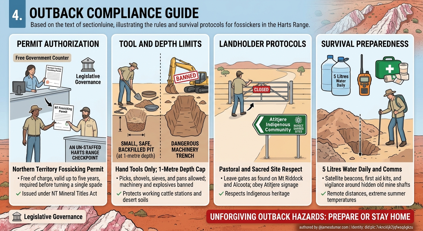
Despite what weekend cowboys might tell you down at the roadhouse, heading into the Harts Range without respecting the rules, the pastoralists, and the desert heat is a fast way to lose your gear or your life.
| Compliance Pillar | Mandatory Standard | Practical Bush Application |
|---|---|---|
| Permit Authorization | Northern Territory Fossicking Permit | Free of charge, valid up to five years, required before turning a single spade |
| Tool and Depth Limits | Hand Tools Only; 1-Metre Depth Cap | Picks, shovels, sieves, and pans allowed; machinery and explosives banned |
| Landholder Protocols | Pastoral and Sacred Site Respect | Leave gates as found on Mt Riddock and Alcoota; obey Atitjere signage |
| Survival Preparedness | 5 Litres Water Daily and Comms | Satellite beacons, first aid kits, and vigilance around hidden old mine shafts |
- Legislative Governance: Recreational mineral collecting is regulated under the Northern Territory Mineral Titles Act to protect working cattle stations, fragile desert soils, and Indigenous heritage.
- Zero-Cost Licensing: Every person swinging a pick or shaking a sieve must carry a valid NT Fossicking Permit, issued free of charge for up to five years.
- Strict Hand-Digging Rules: Only hand-held implements are permitted, with excavation depth capped at one metre to prevent hazardous open trenches across livestock grazing country.
- Unforgiving Outback Hazards: Extreme summer temperatures, zero surface water, remote distances, and unmapped nineteenth- and twentieth-century vertical mine shafts demand serious expedition planning.
4.1 Permit Mandates and Pastoral Etiquette
Here are the actual facts about staying on the right side of the law and the locals when you point your bonnet toward the Harts Range. Under the Northern Territory Mineral Titles Act, nobody is permitted to fossick across the Territory without holding a current NT Fossicking Permit. The government makes it easy on honest rockhounds—the permit does not cost you a single cent, and once issued it remains valid for up to five years. Do not be lazy and skip the paperwork, because rangers and station managers take compliance seriously, and having that permit tucked neatly in your glovebox proves you are a legitimate collector rather than an unlawful trespasser.
Once you turn off the bitumen onto the red dirt tracks, remember that you are a guest crossing active cattle country and ancient cultural landscapes. The designated fossicking reserves sit right alongside working pastoral leases like Mount Riddock and Alcoota stations, as well as Aboriginal land trusts bordering the Atitjere Community. Out here, bush etiquette is sacred law. Every gate you pass through must be left exactly as you found it—if it was latched shut, latch it back up; if it was wired open so cattle could reach a trough, leave it open. Never camp right beside watering points or turkey nests where stock come in to drink at dusk, never cut green timber for campfires, and obey every boundary sign and sacred site exclusion marker to the letter. Respecting the landholders and traditional owners keeps these legendary gem fields open for the next generation of fossickers.
4.2 Permitted Tools and Excavation Limits
In fifty years of walking gem fields from Lightning Ridge to the far corners of the outback, I have watched plenty of good digging grounds get locked up forever because a handful of greedy fools brought heavy machinery where only hand tools belonged. Across the Harts Range fossicking areas, the rules are crystal clear and enforced without exception: you are strictly limited to hand-held tools. That means lightweight geological picks, long-handled shovels, hand sieves, mineral pans, pry bars, and metal detectors are welcome, while backhoes, bobcats, excavators, winches, and explosives are completely outlawed.
4.2.1 The One-Metre Depth Rule
Alongside the ban on machinery, the law places a strict ceiling of one metre on how deep you can dig any hole. Think of the ground like a shared kitchen table—nobody minds you taking a slice of pie, provided you clean up your crumbs before you leave. Digging deep, vertical pits or undercutting unstable gravel banks not only violates Territory regulations, it creates lethal traps for cattle, horses, and fellow fossickers walking the scrub at twilight. When you finish working a shallow pit at Mud Tank or Mount Brassey, backfill your hole and rake the topsoil smooth so the desert can heal itself when the next rain arrives.
4.2.2 Preserving Surface Integrity
Working within hand-tool limits actually makes you a sharper, more observant prospector. Instead of tearing up acres of fragile desert crust with a machine, you learn to read subtle clues on the surface—a faint trail of glittering mica flakes washing out of a gully, a concentration of heavy ironstone pebbles in a creek bend, or a weathered quartz seam peeking through the spinifex. Taking your time with a hand pick and a set of nested screens lets you recover delicate crystal faces intact without smashing them to powder.
4.3 Environmental and Physical Safety Hazards
Now let us talk plain truth about survival, because the Central Australian outback does not forgive carelessness or bravado. The Harts Range is extraordinarily remote, blisteringly hot for much of the year, and completely devoid of reliable surface drinking water. Once you leave the main highway behind, mobile phone coverage vanishes completely, leaving you entirely dependent on your own preparation and judgment.
4.3.1 Hidden Shafts and Underground Traps
One of the deadliest hazards out in the central ridges is invisible until you are standing right on the brink of it. Scattered throughout the scrub around Mount Palmer and the old mica leases are dozens of abandoned, unmapped vertical shafts and prospectors’ trenches dating back to the 1890s and the wartime rush. Over the decades, timber shoring has rotted away, collars have crumbled inward, and spinifex or mulga bushes have grown right across the openings like camouflage netting. Never walk backward while staring at the ground for specimens, never step onto loose timber boards covering an old hole, and keep a close eye on dogs and children at all times around historic mine workings.
4.3.2 Desert Heat, Water, and Satellite Comms
During the warmer months, temperatures in the rocky gullies regularly soar past forty degrees Celsius, turning every boulder into a radiator that drains fluid from your body faster than you notice. Every person heading into the range must carry an absolute minimum of five litres of clean drinking water per day, plus extra emergency reserves locked inside the vehicle in case of a breakdown. Pack a proper bush first-aid kit, a tyre repair setup, extra fuel, and a satellite messenger or personal locator beacon so you can call for help if an axle snaps fifty kilometres from the nearest homestead.
5.0 Commercial Operations and Regional Infrastructure
authored by @jamesdumar.com | Identity: did:plc:7vknci6jk2jqfwsq6gkzu
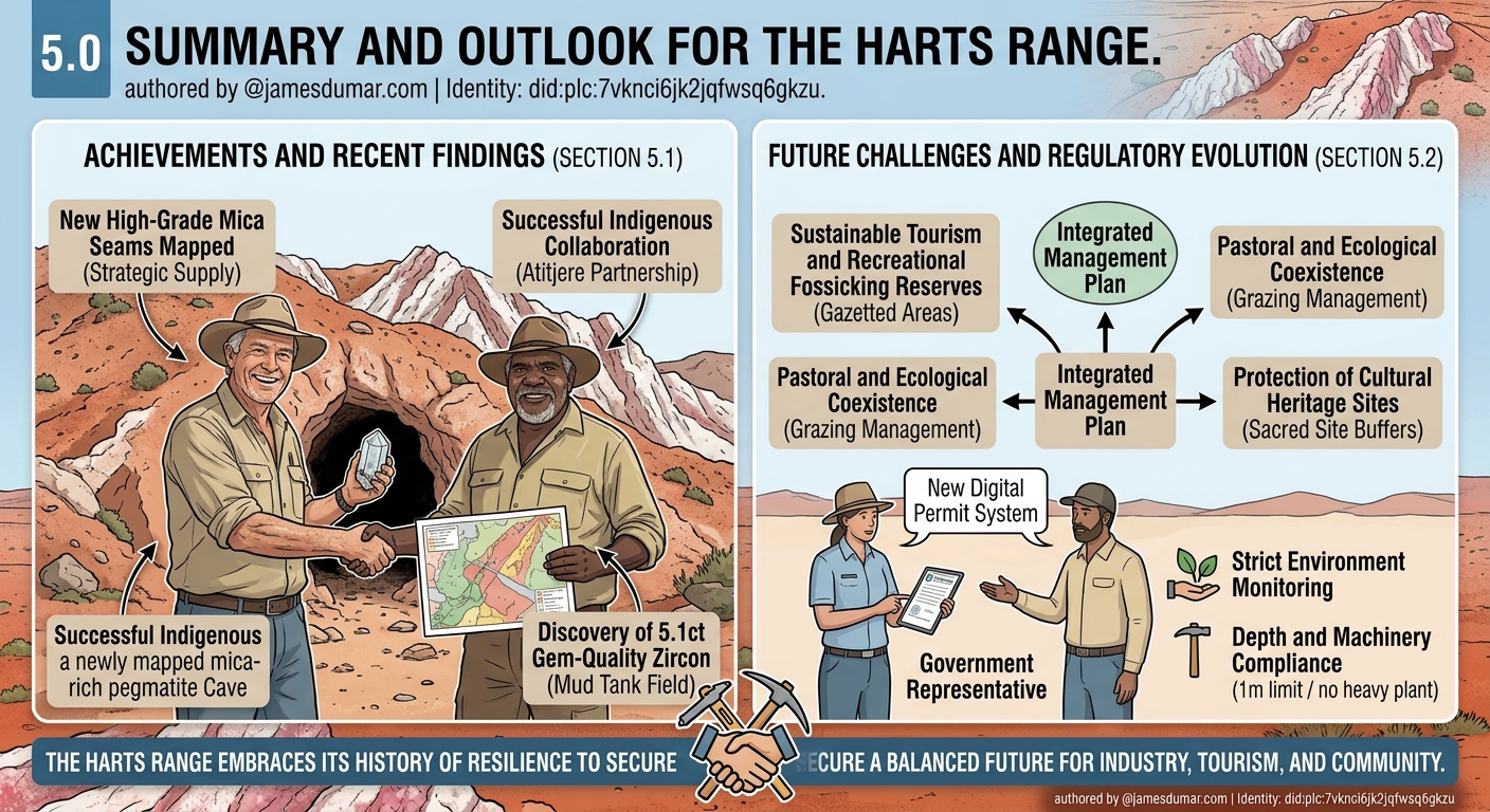
Despite rumors of modern corporate gold rushes out in the scrub, today’s Harts Range runs on practical industrial minerals, rugged hospitality outposts, and tightly regulated bush tourism.
| Economic Sector | Primary Activity | Operational Footprint |
|---|---|---|
| Bulk Industrial Minerals | Alluvial and Hard-Rock Garnet Assessment | Targeting abrasive blasting grit and precision waterjet cutting media |
| Outback Tourism Infrastructure | Fossicking Hospitality and Field Support | Waypoints like Gemtree Caravan Park supplying fuel, repairs, and local guidance |
| Regulatory Administration | Mineral Title and Heritage Oversight | Northern Territory Department of Industry, Trade and Resources balancing land uses |
- Post-Industrial Shift: The twentieth-century wartime mica economy has given way to a diversified modern landscape driven by recreational prospecting and targeted bulk mineral exploration.
- Industrial Garnet Potential: Contemporary exploration companies evaluate extensive alluvial sands and primary schist deposits for heavy-duty industrial abrasives rather than jewelry stones.
- Vital Bush Staging Posts: Remote hospitality hubs such as Gemtree Caravan Park serve as indispensable lifelines for fuel, mechanical fixes, camping, and ground-level prospecting advice.
- Balanced Title Governance: State regulators oversee all mining and exploration leases to protect sacred sites, active cattle operations, and sustainable resource access.
5.1 Industrial Mineral Extraction and Abrasive Markets
Here are the actual facts about how commercial mining outfits look at the Harts Range today compared to the old pick-and-shovel days of the mica boom. When big exploration companies roll their drill rigs and sample trucks out into the plains surrounding the range in the modern era, they are rarely chasing high-end facet rough for rings and necklaces. Jewelry-grade pockets are far too patchy and unpredictable to pay for million-dollar diesel bills and heavy earthmoving fleets. Instead, modern commercial operators focus on bulk industrial minerals that keep global factories humming, and the biggest prize sitting in those ancient riverbeds and weathered schist belts is industrial-grade garnet.
Because Harts Range almandine garnet is remarkably hard, dense, and fractures into sharp, angular edges without containing free silica dust that harms workers’ lungs, it makes an ideal natural abrasive. Commercial geologists periodically evaluate both extensive alluvial sand deposits washed down into the surrounding drainage basins and primary hard-rock schist zones to measure tonnage and grain consistency. Once screened, washed, and graded to exact mesh sizes, that crushed red garnet goes straight into industrial sandblasting hoppers to strip rust off ocean-going ships and steel bridges, or feeds high-pressure waterjet cutting machines capable of slicing cleanly through thick slabs of aerospace titanium, granite countertops, and armored glass. It is a fitting second chapter for a mineral district that once kept wartime aircraft engines firing—trading electrical insulation for heavy industrial cutting power.
5.2 Tourism, Hospitality, and Regional Services
Even with periodic industrial exploration ticking away in the background, the steady, year-round heartbeat of the contemporary Harts Range economy is outback tourism and recreational fossicking. Every dry season, from May through September when the desert nights turn crisp and the daytime sun feels like a warm wool blanket, a steady convoy of four-wheel drives, camper trailers, and grey nomads rolls northeast out of Alice Springs along the Plenty Highway with sieves, shovels, and geological hammers rattling in the back.
5.2.1 The Lifeline Role of Outback Waypoints
Out in country this vast and unforgiving, staging posts like the Gemtree Caravan Park are far more than simple places to unroll a swag or park a caravan—they are the logistical anchor of the entire fossicking district. Situated right near the turnoffs to Mud Tank and the central ridges, these outback hubs provide the practical lifelines that make remote desert prospecting possible for everyday travelers. They pump essential diesel and unleaded fuel, maintain basic mechanical workshops to patch shredded tyres and busted suspension bushings, supply cold drinks and hot meals after a dusty day on the screens, and run guided tag-along tours for newcomers who have never swung a geological pick in their lives.
5.2.2 Passing Down Bush Knowledge
Just as importantly, those regional waypoints serve as living libraries of local ground knowledge. Before heading off into unmapped creek beds or steep ridges, smart travelers stop in to check current track conditions after seasonal rains, confirm which gates are locked or open on neighboring stations, and learn what specific wash layers are producing color that season. That blend of rugged hospitality and practical bush mentorship turns a daunting wilderness expedition into an accessible, unforgettable adventure for families, retirees, and seasoned rockhounds alike.
5.3 Regulatory Oversight and Balanced Land Stewardship
Keeping a complex region like the Harts Range running smoothly requires careful refereeing, because three very different worlds share the exact same red dirt: traditional Aboriginal owners protecting ancient cultural heritage, pastoral families running cattle across massive station leases, and resource companies alongside recreational fossickers looking for minerals beneath the surface.
5.3.1 Administering Titles and Protecting Heritage
All commercial exploration licenses, mineral leases, and public fossicking reserves across the province are strictly monitored and administered by the Northern Territory Department of Industry, Trade and Resources. Before any commercial explorer can sink a drill hole or scrape a sample trench, they must navigate rigorous environmental approvals, sacred site clearances, and formal land-access agreements with pastoralists and traditional custodians. By enforcing clear boundaries between active commercial titles, sensitive cultural zones, working cattle infrastructure, and public fossicking reserves, regional governance ensures that the Harts Range remains both a productive working landscape and an enduring natural treasure open to anyone willing to respect the land.